About the Galore Creek Mining Project
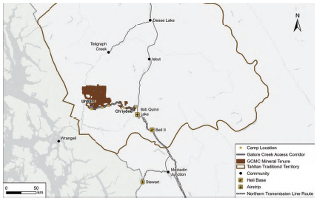
Located in Northwestern British Columbia, within Tahltan Territory, approximately 110 kilometers southwest of Dease Lake, the Galore Creek Project boasts a rich history. The deposit was originally discovered in the 1950s. The project undertook an environmental assessment and received approval in early 2007, followed by the initiation of access construction. Then the Project was suspended in late 2007 and has since been conducting exploration, resource development, and environmental and engineering studies. The Galore Creek Mining Corporation is currently working through a comprehensive pre-feasibility study (PFS) aimed at refining the previously approved Project in preparation for initiating a regulatory process to update and modernize existing approvals.
The PFS is a multifaceted program encompassing a substantial field program, including helicopter-supported drilling, focused on geotechnical, metallurgical, and resource development, environmental baseline studies are in progress across the entire Project area, test pitting and geotechnical activities to characterize surface materials for proposed infrastructure placement and general site operations which includes supporting a remote helicopter-accessible camp with up to 150 people. The team is actively engaged in aligning with Tahltan values and working with local communities related to the Galore Creek Project activities.
Challenge
One of the primary challenges the Galore Creek Project faces is the absence of road access to most of the Project area. Helicopter transport remains the sole means of reaching key areas where studies are focused. The closest remote airstrip is located at Bob Quinn Lake, approximately 85 kilometres east of the project along Highway 37. Staff members are transported from Bob Quinn or Ch’iyone Camp via helicopter. The organization operates these aircraft primarily from April to October each year, with baseline surveys continuing through the winter months.
Solution
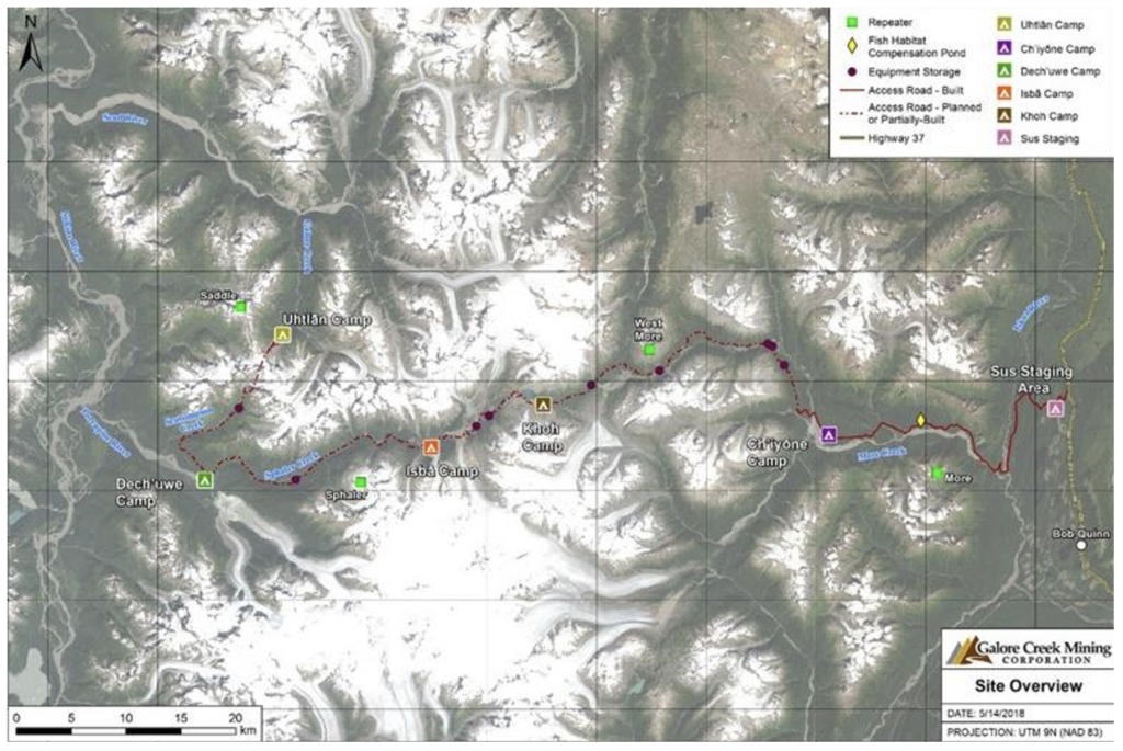
In June 2021, the Galore Creek Mining Corporation installed three (3) Nupoint System remote camera pods in known problematic weather locations along the flight path to the Galore Valley. These cameras capture photographs of weather conditions between Ch’iyone Camp and Uthlan Camp every 15 minutes during daylight hours. These images are available to the pilots and dispatchers, enabling them to assess weather conditions before departing and aiding their decision-making process regarding flight feasibility and safety.
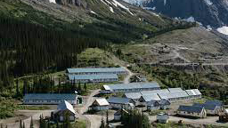
Many activities are staged out of Ch’iyone Camp, which is approximately 36 kilometers from Hwy 37 along the partially constructed Galore Creek access road. Flights from Bob Quinn to Ch’iyone camp follow a lower elevation route along the Iskut River Valley then up More Creek. However, the journey from Ch’iyone Camp to Uthlan Camp traverses more challenging mountainous flight paths that can be challenging due to high precipitation, fog, mist, and limited visibility. One of the key challenges was the pilots’ lack of prior knowledge of enroute weather conditions before departing Ch’iyone Camp, often resulting in aborted trips, inefficient resource usage, and potential precautionary landings due to adverse weather.
James Carr, a key member of the field operations team and consultant from Veritas Aviation Solutions, played a pivotal role in setting up the Nupoint Systems cameras, emphasizing the numerous safety and economic benefits. The cameras provide field personnel and pilots with knowledge of the weather conditions, mitigating the need for turnarounds due to poor weather, providing cost savings, and, most importantly, ensuring the safety of all staff members and flight crews through better-informed decision-making.
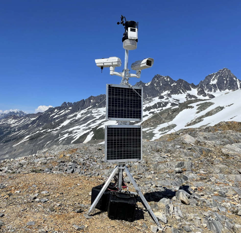
The camera systems are mounted on tripods at the start of each field season and removed in the fall. Their removal for winter is a precaution necessary due to the mountainous terrain, where more than 20 feet of snow can accumulate during the winter months.
Overall, the implementation of the Nupoint camera system at the Galore Creek Project has improved the planning and management of helicopter activities, resulting in a safer more efficient program.